1. Download the Pix4D capture app (available on App store/Google Play)
2. Sign up
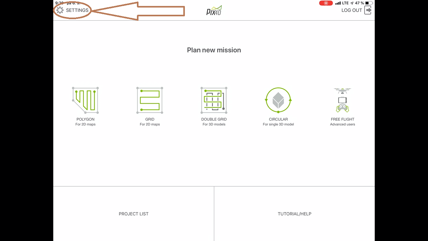
3. Tap on Settings
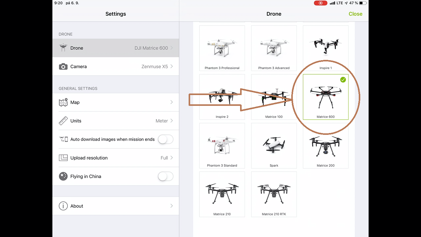
4. Choose DJI M600
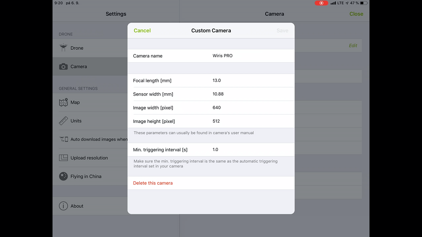
5. Tap on „Camera“ ► „Add custom camera“
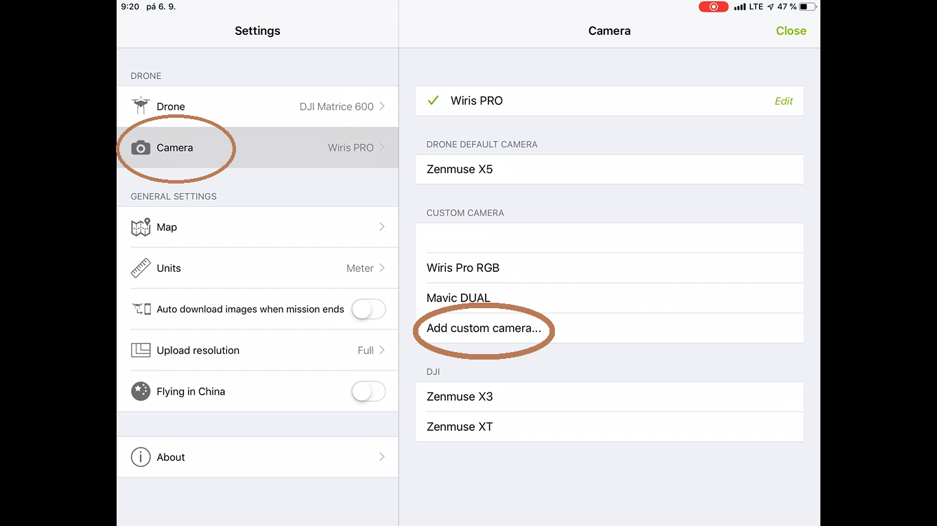
6. Type this values
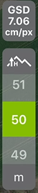
7. Choose the flight level (height of flight). The flight level refer with the GSD (Ground Surface Resolution). We often use 50 m (100 m for bigger area). Note: the flight level impact the flight time.
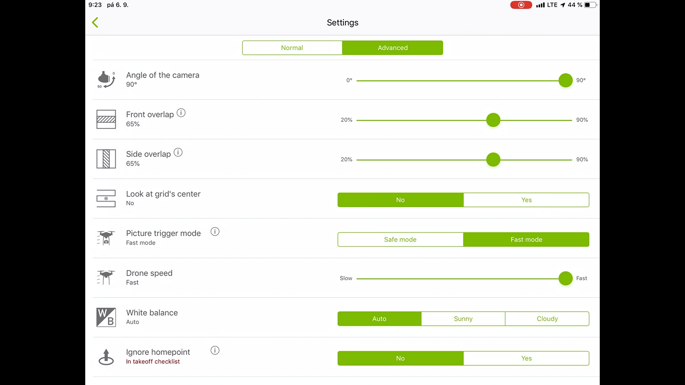
8. Go to settings in upper right corner and set up values for fast images capture.
9. Save the project

10. Turn off Pix4D Capture app
11. Turn on the DJI GO app
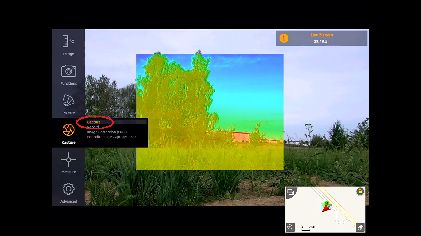
12. Go to „Range“ and set up the Manual temperature range
13. Go to „Advanced“ to „Images&Video“ and choose „radiometric Tiff“ for saving. (for visible map choose vis jpg too)
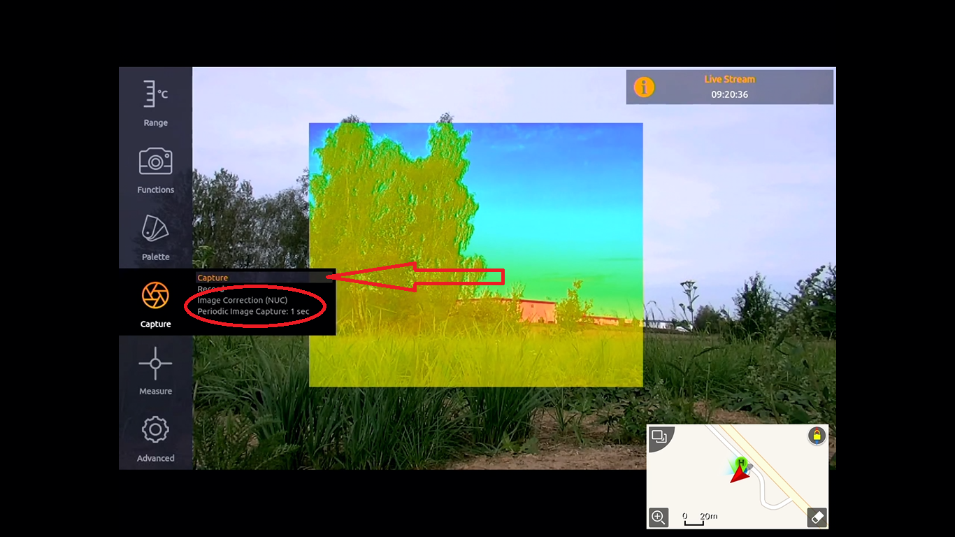
14. Go to „capture“ and do NUC (Non Uniformity Calibration)
15. Choose 1s periodic capture for fast speed of capturing, or choose the flight level and below speed parameter, which reference for capture the image.
16. Start capture
17. Turn off the DJI GO app from multitask
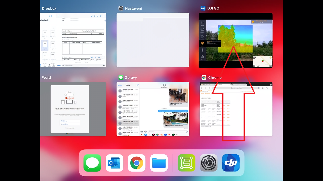
18. Tap on Pix4D capture
19. Open the saved mission
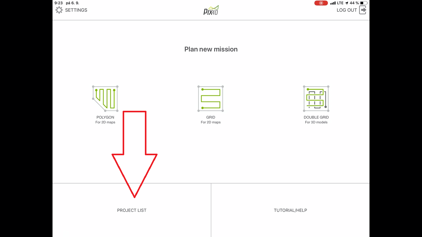
20. Tap on „Open“
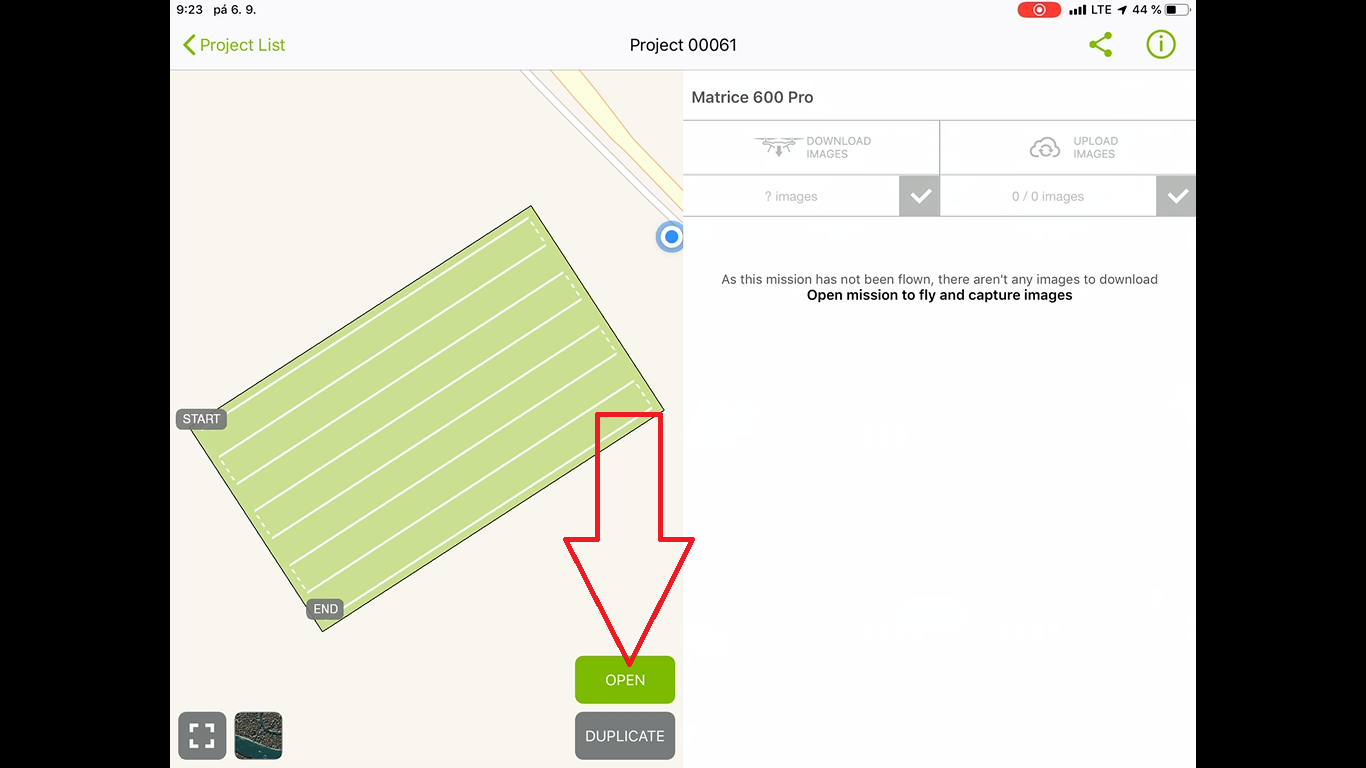
21. Tap on „start button“ the app going to send the flight plan to the drone, tap on next
22. Important: This step cause start of rotors/engines!
Tap on start button

23. After a drone landing and engines shut down, turn off the pix4d capture from multitask (same as in the step 10) ► tap on DJI GO app ► turn off the capturing