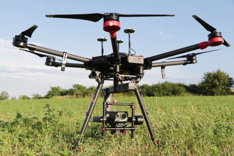
Infrared cameras for thermal drone have become an increasingly popular tool in the world of thermal imaging, with a wide range of applications across various industries. One such application is in the field of drone technology, where infrared cameras are utilized to provide valuable insights and data. Thermal drones equipped with infrared cameras have proven to be incredibly useful in a range of scenarios, from detecting heat leaks in buildings to tracking wildlife at night. The use of thermal drones equipped with infrared cameras has revolutionized the way we gather information and has opened up new possibilities for industries such as construction, agriculture, and search and rescue. In this context, the following paragraphs will provide a deeper insight into the benefits and applications of infrared cameras in thermal drones.
Workswell is offering four different infrared cameras for thermal drone:
- Camera no. 1: Fully radiometrics thermal cameras – like WIRIS Pro and WIRIS Pro SC are infrared cameras for thermal drones used in the area of industrial inspections, technical diagnostics, predictive maintenance etc. LWIR camera with spectral range 7.5 – 13.5 μm.
- Camera no. 2: Optical gas imaging camera – GIS-320 is a optical gas imaging camera for drones. Drone with that camera becomes a useful device for gas leaks detection. MWIR thermal camera with spectral range 3.2 – 3.4 µm.
- Camera no. 3: Security camera – WIRIS Security is a thermal camera for night vision drones, mostly used in the area of search and rescue. This camera is categorized as a NON-ITAR product, which means that the sale, export, and import of this thermal camera is considerably easier and faster than it would be for an ITAR unit. LWIR camera with spectral range 7.5 – 13.5 μm.
- Camera no. 4: CWSI camera – WIRIS Agro R is a special infrared camera, designed for drones in the field of precision agriculture. This thermal camera responds to the issue of water management research but camera also include standard funtions of radiometrics thermal camera. LWIR camera with spectral range 7.5 – 13.5 μm.
All these cameras run one of the versions of the WIRIS OS operating system developer by Workswell. Selected models of thermal cameras are also offered as OEM solutions: WIRIS Pro OEM and WIRIS Security OEM.
Fully Radimetrics
Infrared cameras for thermal drone
Camera no.1: WIRIS Pro - Fully Radimetrics Thermal Cameras
WIRIS Pro and WIRIS Pro SC are fully radiometrics and calibrated cameras for applications where it is necessary to determine the actual surface temperature. They are used mainly in the field of technical diagnostics, predictive maintenance, condition monitoring etc. The resolution of these infrared cameras for thermal drone is 640×512 px and the thermal sensitivity is 50 mK respectively 30 mK for WIRIS Pro SC. Typical applications are for instance: Power line inspection, flat roofs inspection, photovoltaics power plant inspection, building diagnostics, pipeline inspection, and more… Cameras are available in 9 Hz and 30 Hz versions. Standard video output is HDMI. WIRIS Pro and WIRIS Pro SC also allows video streaming via Ethernet. The cameras store fully radiometric thermal images (thermograms), RGB images and have the option of recording radiometric video.
SDKs (Standard Development Kits) for data post processing and data streaming control are also available.
Workswell supplies these infrared cameras along with the thermal drone to offer a ready-to-fly solution for your demanding applications
WIRIS Pro Introduction – Thermal Camera for Pipeline Applications
WIRIS Pro is Used All Around the World
Optical gas
Infrared cameras for thermal drone
Camera no. 2: GIS-320 - Optical Gas Imaging Camera
Workswell GIS-320 is a gas imaging camera for thermal drones. Workswell GIS-320 works on the principle of changing the radiation of the surroundings due to the flowing leaking gas. Workswell GIS-320 uses a unique spectral filter method. The filter is mounted in front of the detector and cooled along with it to prevent any radiation exchange between the filter and the detector. The filter restricts the wavelengths of radiation allowed to pass through to the detector to a very narrow band called the band pass. For all gas compounds, infrared absorption characteristics is wavelength dependent. Selecting a filter that restricts the camera to operating only in a wavelength where a gas has high absorption spike (or transmission trough) will enhance the visibility of the gas. These infrared cameras for thermal drone become really popular.


See in full resolution
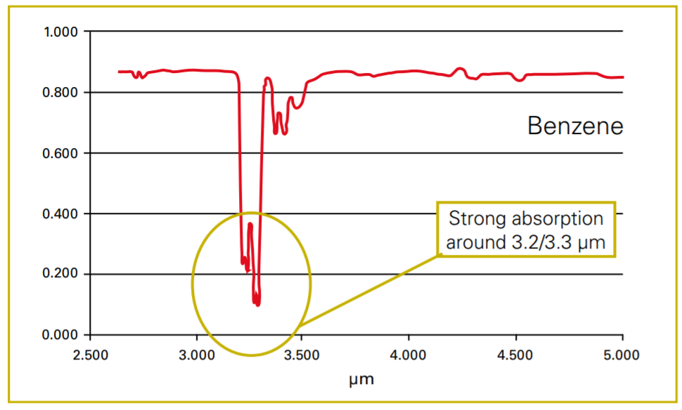
Here is for instance spectral absorption of benzene. The gas is largely absorbed on a wave length of about 3.2µm. This can be used when detecting this gas by OGI thermal camera like Workswell GIS-320. The Workswell GIS-320 is the ideal solution when paired with unmanned air vehicles (drones/UAV systems). Both can be fully operated with one standard RC controller. Remote control of the thermal camera can be accomplished by using the two available input types, CAN bus (1 port) and PWM (4 free ports and 1 for the S.BUS).
There is on the picture spectral absorption of benzene. The gas is largely absorbed on a wave length of about 3.2µm. This can be used when detecting this gas by thermal camera. The Workswell GIS-320 contains a digital camera (full spectrum). Its resolution is 1920 x 1080 pixels and it has 10x optical zoom, which aids in the inspection of specific areas
GIS-320 could offer a 320×240 resolution and capability to detect those gases: Benzene, Ethanol, Ethylbenzene, Heptane, Hexane, Isoprene, Methanol, MEK, MIBK, Octane, Pentane, 1-Pentane, Toluene, Xylene, Butane, Ethane, Methane, Propane, Ethylene.
A more detailed description of the principle of physical operation of gas cameras.
Gas Leakage Detection Using GIS-320 Example
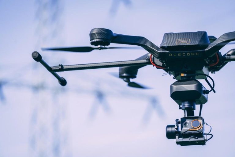
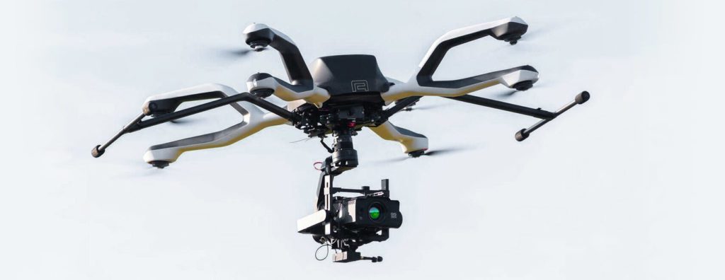
GIS-320 with NEO Thermal Drone from AceCore – Perfect Solution for Optical Gas Imaging (OGI)
Workswell GIS-320 Main Features
- Up to 400 gases are detectable (OGI camera – gas detection camera)
- Calibrated temperature measurement
- High sensitivity sensor 0.015°C
- 10x optical RGB zoom integrated
- Plug&play integration for any drone
Security
Infrared cameras for thermal drone
Camera no. 3: WIRIS Security – Thermal Camera for Search and Rescue
Workswell WIRIS Security is a non-radiometrics thermal camera for drones we colling simply night vision drones. Main parameters of WIRIS Security camera are a very high thermal resolution 800x600px, high frame rate 25 Hz and perfect thermal sensitivity 40 mK. You can see the relevancy of these parameters in the video that showing monitoring of objects of different distances and sizes using the WIRIS Security thermal camera.
Workswell supplies WIRIS Security along with the thermal drone to offer a ready-to-fly solution for your night vision or search and rescue applications.
RTSP video streaming, image, and command transfer through Wi-Fi are among the other WIRIS OS functionalities. These features are provided by the RJ 45 Ethernet port. See more information in the Stream SDK tutorial.
Resolution Matters – Night Vision Drone with WIRIS Security
WIRIS Security – Short Introduction
WIRIS Security Main Features
- 800 x 600px thermal resolution with narrow 18° lens (35mm)
- 30x optical zoom RGB (up to 129mm) with stabilisation
- Visible Night vision channel
- Picture-in-Picture with 30x optical zoom
- Encrypted wireless video IP streaming
CSWI Camera
Camera no. 4: CWSI Camera – Camera for Precision Agriculture
Workswell’s WIRIS® Agro R is the first device of its kind designed to map water stress across large areas in the field of precision agriculture and at the same to measure and evaluate the temperature information.
Although there are many uses, we can divide the main WIRIS Agro R functions into these four categories:
- Water status monitoring– Water stress is the plant’s response to deficiencies in the water supply during the growing season, regardless of whether the crops are irrigated or not. To enhance monitoring, the AGRO creates special color maps, “Crop” and “CropStep.”
- Irrigation management– This facilitates irrigation system optimization in terms of determining optimal locations for soil sensors, and in terms of structural optimization. The special color maps, “Water” and “WaterStep,” are available for this use.
- Phenotyping– Plant varieties respond differently to the amount of water available to them. The WIRIS Agro R will help you determine how often the plants of a given species are in water stress, compared to plants of other species.
- Biomass Cover Index – For real-time calculation of the field’s plant cover.
By comparing yields from different months and years depending on water stress, a potential yield map can be created according to the current water stress value. This map provides:
- real-time onboard CWSI evaluation
- real-time CROP and WATER color map vizualization
- real-time additional information on how the crop is impacted by drought
- real-time Biomass cover index evaluation in %
- real-time Picture-in-Picture CWSI index and RGB
Each pixel on the map below shows the level of water stress according to the CWSI index in the range 0 to 1. The information can be used to evaluate the properties of crops (resistance to induced water stress) or, for example, to determine the effectiveness of the irrigation system.


See more details in full resolution
WIRIS Agro Main Features
- Calibrated temperature measurement
- Water status monitoring
- Manage irrigation management
- Phenotyping, biomass cover index evaluation
- Real-time and offline vizualization
- 2D and 3D software analysis